
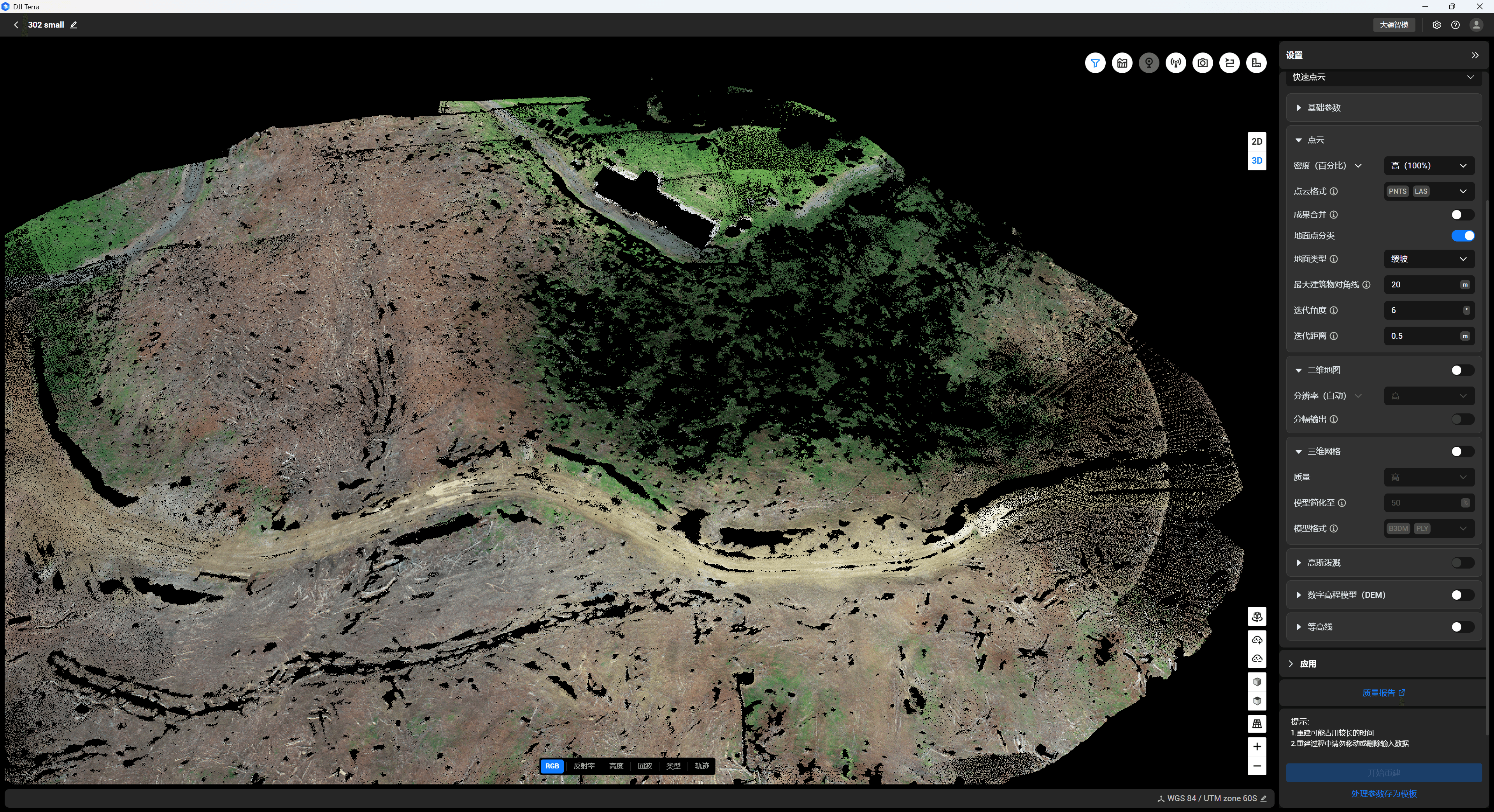
LiDAR
LiDAR (Light Detection and Ranging) captures high-density 3D point clouds by emitting laser pulses and measuring returns. It is ideal for large sites, complex terrain, and vegetation-heavy areas where traditional ground surveying is slow, risky, or incomplete.
Ultimate solutions for powerline modelling▾
Picks up 12mm conductros and isolaters, best solutions for powerline company to digitalize their assests.
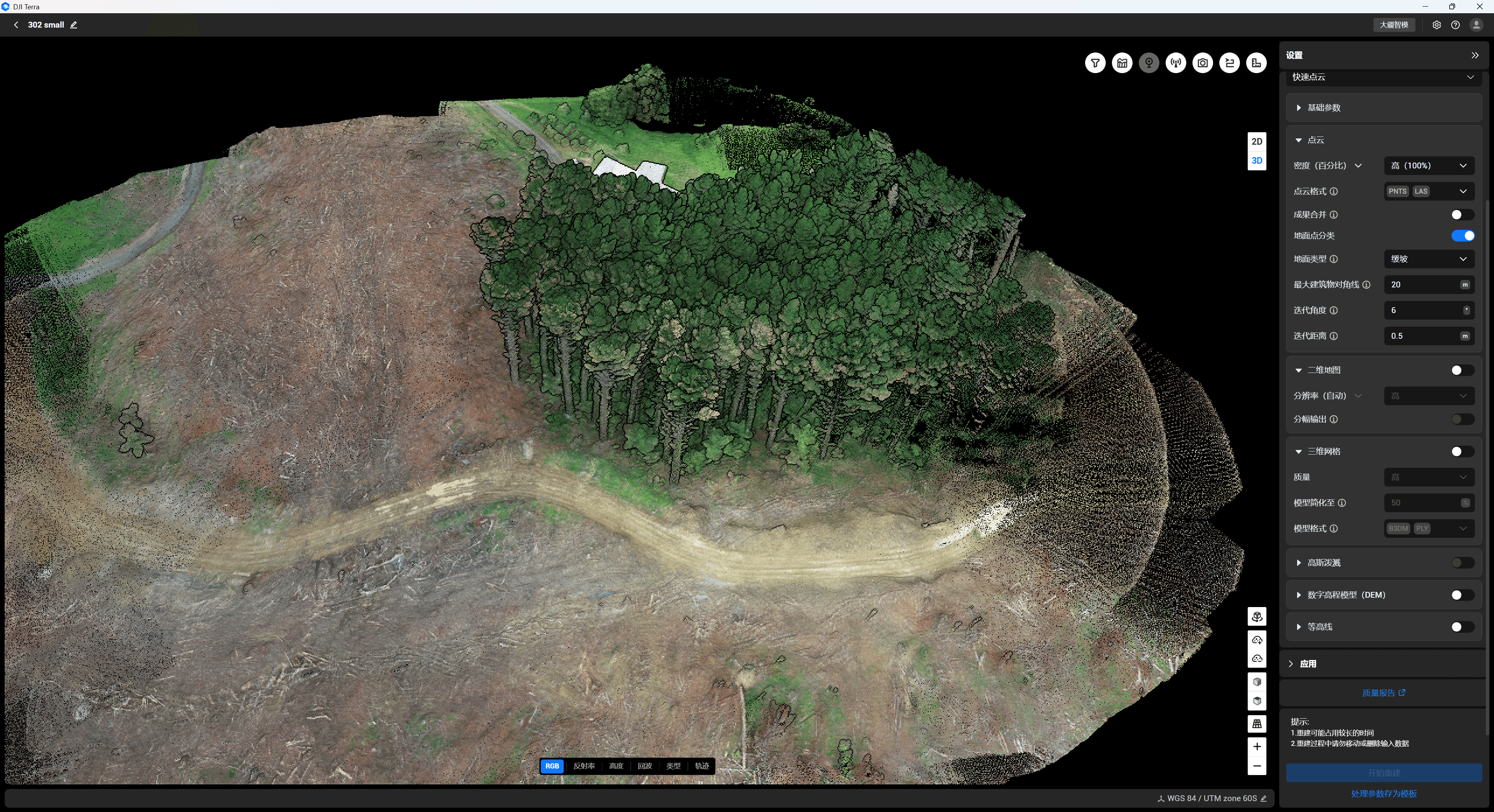
Ultimate solutions for forest tree seperation ▾
The best solution to count trees in large scale forest, seperate trees into indivials, access heights, width density etc
Ultimate solutions for river/stream/cliffs data collection ▾
The best solution to get the hazadred site a accuracy model, obtain the geo sptrical data at ease(Top of bank, bank width etc), reduce the risks of human access
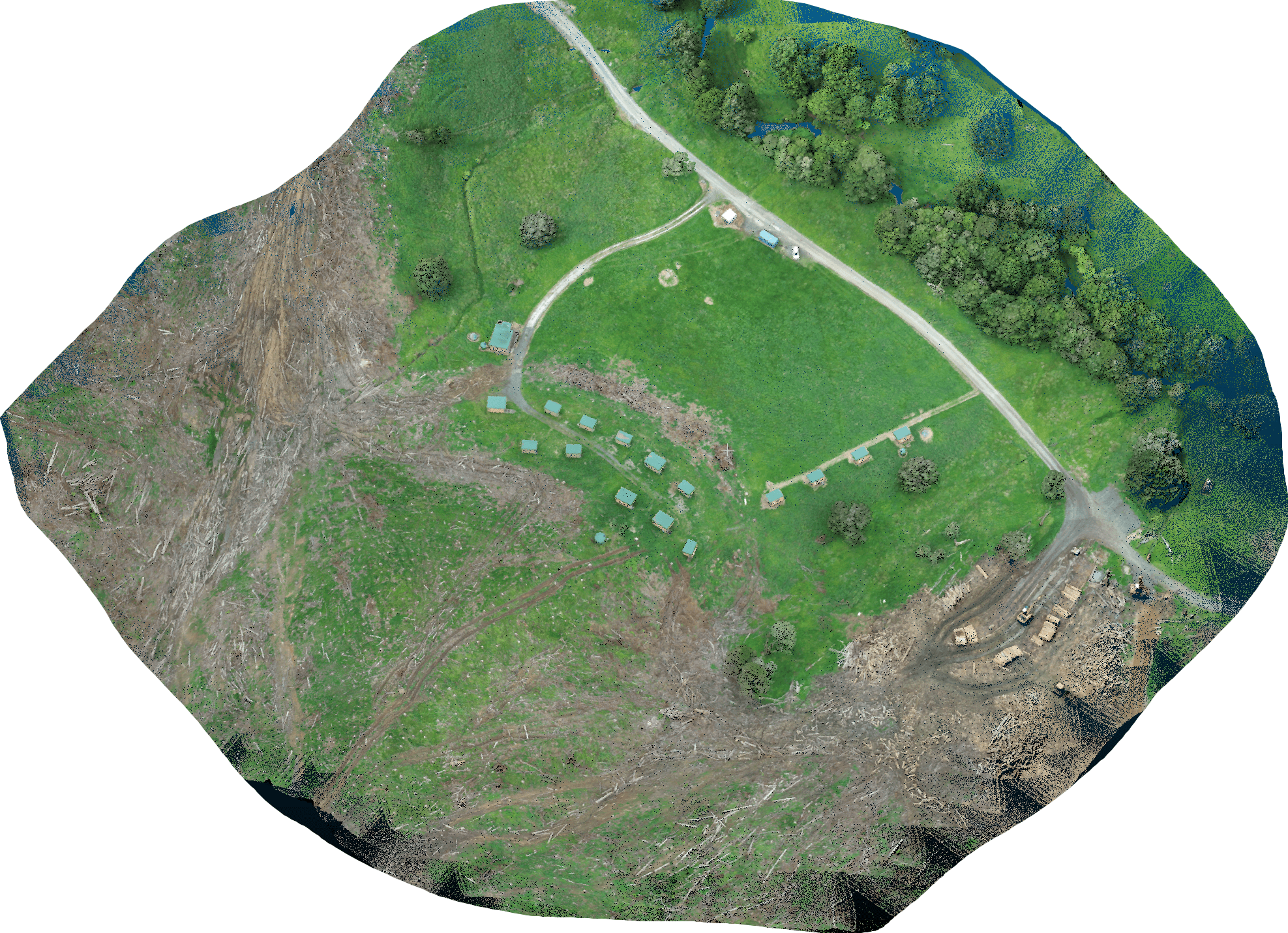
Ultimate solutions for construction stockpile volumes estimation ▾
The best solution to measure stockpile volumes, without afffecting the daily operation, no need to step into the hazrds site. Easy calcultion for cut/fill plan
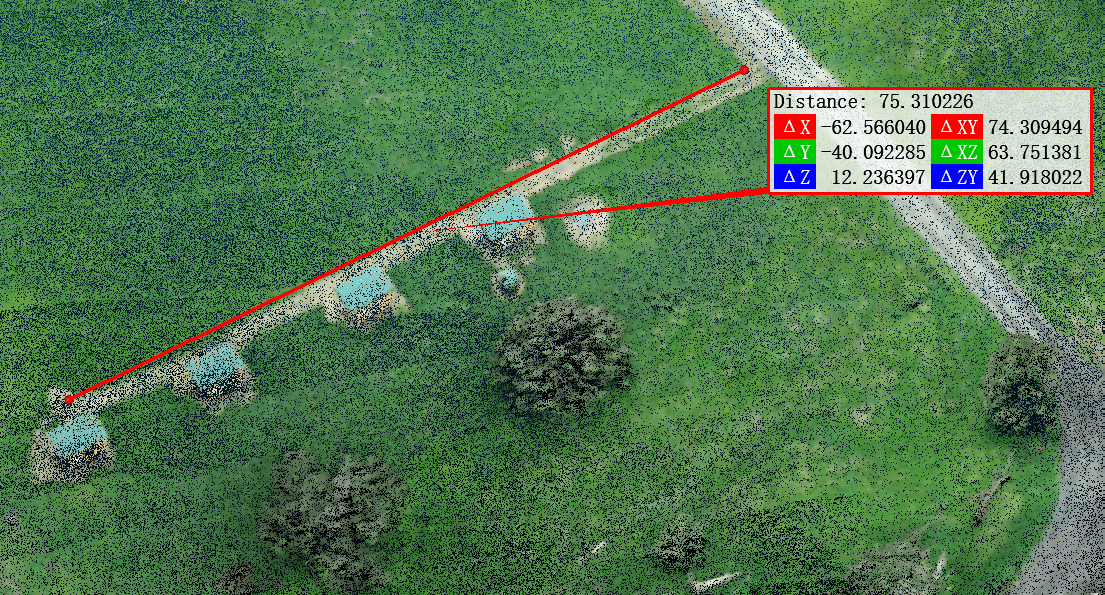
Measurable point cloud models
Measure distance, slope, sections and volumes directly from the model.
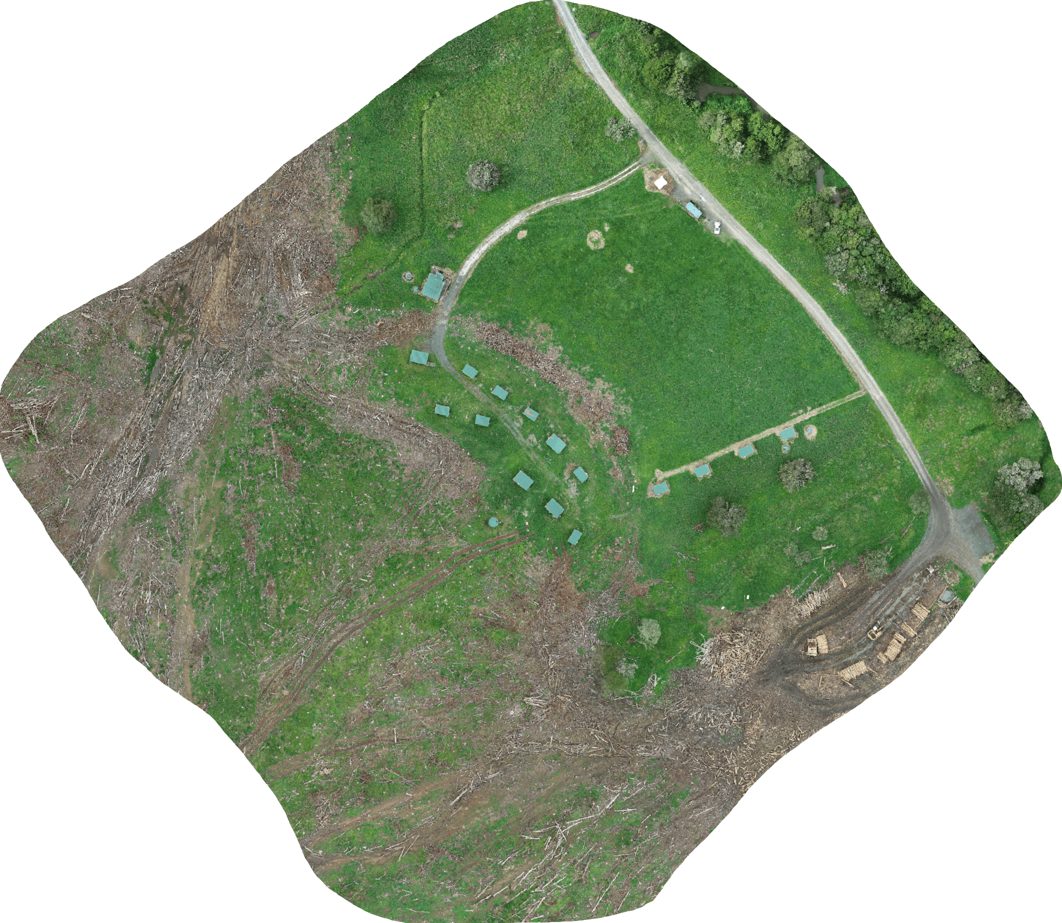
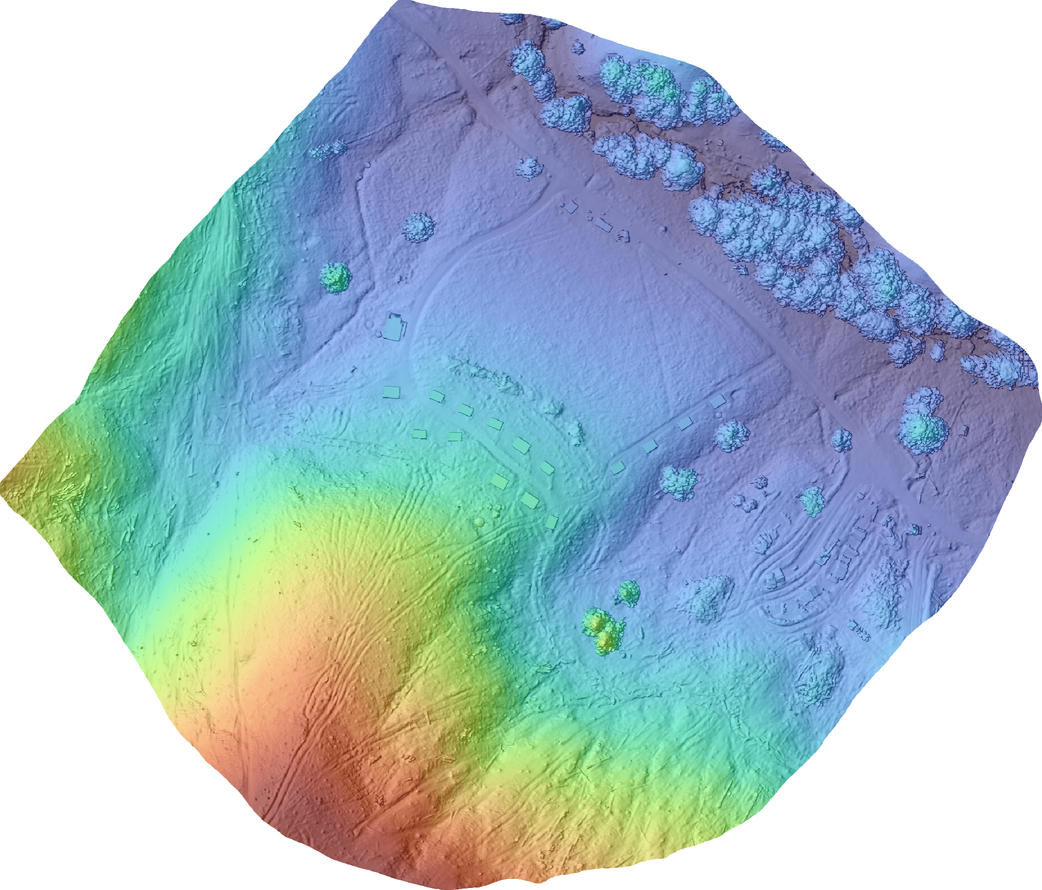
Drag to compare: ground points after vegetation removal
Drag the slider (or the center handle) to compare the original scene/returns versus extracted ground points.
⇆
Original (incl. vegetation / non-ground)
Ground-only (filtered / classified)
← OriginalDrag meGround-only →
Note: This interaction is a visual demonstration. Actual deliverables depend on project scope.
Deliverables
Typical outputs below. We can tailor formats and metadata to match your workflow.
Raw LAS Point Cloud
File format LAZ / PNTS
Digital Orthophoto Map
DOM (georeferenced)
Digital Surface Model
DSM (surface incl. vegetation/buildings)
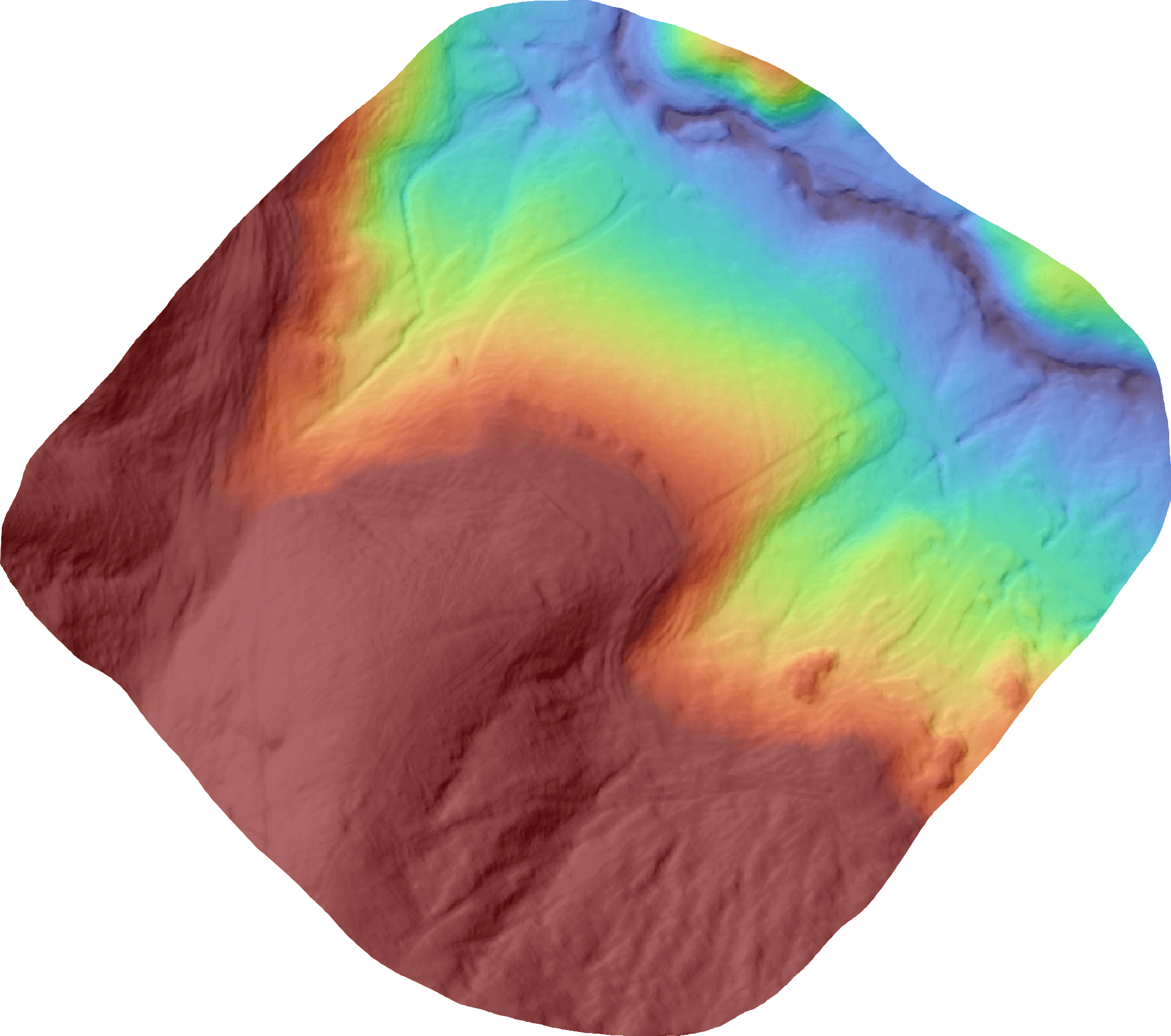
Digital Elevation Model
DEM (ground model after filtering)
Tell us your use case and we’ll recommend the best deliverable package.
Contact us